One of the main complaints of Apple Watch users, especially Apple Watch Ultra users, is that the watch does not have offline maps capability in the Apple Maps app.
With Apple iOS 17 and watchOS 10, this wish finally comes ‘somewhat’ true for many Apple Watch fans who are avid athletes.
In this short article, we explore the various features that Apple has provided to download maps, understand trail conditions, and more.
Contents
Related Reading:
- How to get the Snoopy Watch face and customize it on your Apple Watch
- WorkOutDoors: the most customizable and fully functional workout app for Apple Watch
- Widgets on Apple Watch, A new road to delight watch owners with watchOS 10
About Apple’s offline Maps app capabilities
Before we proceed, it’s important to point out that the new map features, especially the topographical maps, are amazing in look and feel but still need work.
Sadly, using the Maps app, you still cannot save an offline map directly on your Apple Watch. Instead, use your iPhone to download the map via the Maps app, and then Apple shares those offline maps between your iPhone and watch.
It’s still a hard sell to most Garmin users (the feature does not allow you to load routes to your Apple Watch like Garmin); however, Apple Watch athletes who may be thinking of jumping into the Garmin world might now have a good reason to pause and explore these new features available in iOS 17 and WatchOS 10.
These features require an Apple Watch Series 4+, SE, or Ultra running watchOS10+. iOS 17, along with an iPhone XS, iPhone XR, or later running iOS 17 or later.
The best way to understand these new features is to get our hands dirty.
Let’s get started….
How to download offline Trail Maps on your iPhone
- Open the Maps app on your iPhone, running iOS 17 and higher.
- Type in the trail you are interested in exploring in the search box.

- The Maps automatically provides you with a list of trails and trailheads along with trial conditions such as Easy, Moderate, and more if you do not know the specific name.
- Tap on the specific trailhead to get started.
- Apple Maps opens up the trailhead details. These include:

- Driving time estimates and directions.
- Level of difficulty on the trail.
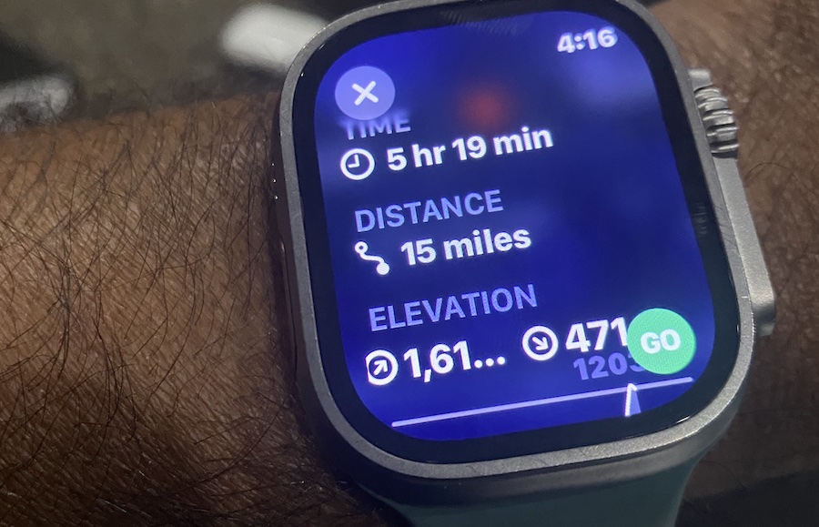
- The Trail Type, Length, Elevation, distance, and duration for the trail.
- An option to add this trail to your Guide by tapping on the three dots at the right
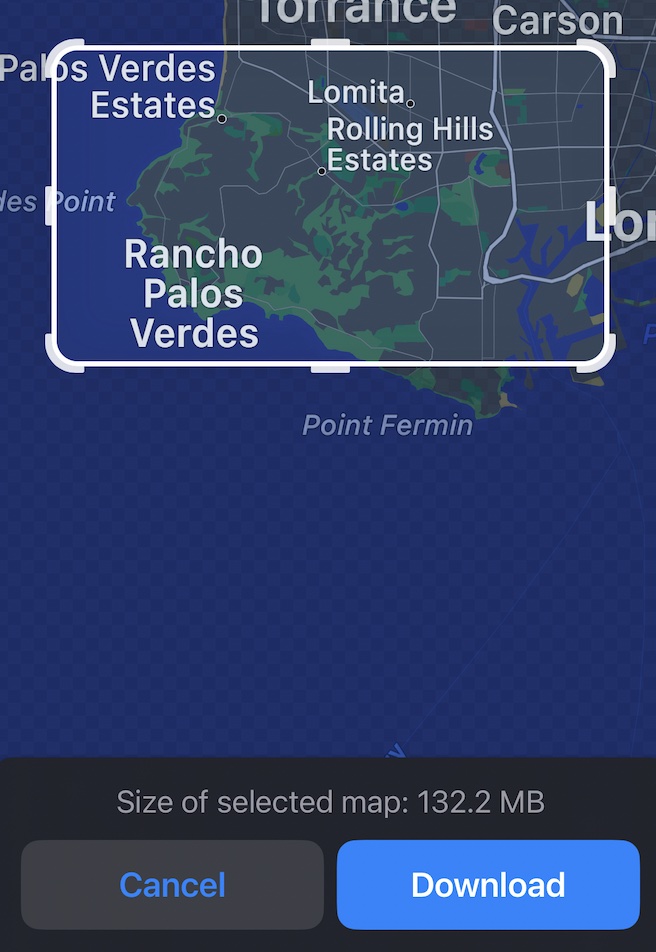
- Next, tap on Download and adjust the Map region that you want Maps to download to your device.

- The system downloads the map details automatically.
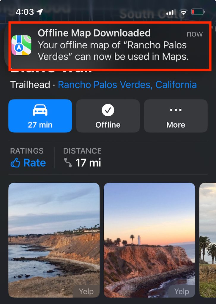
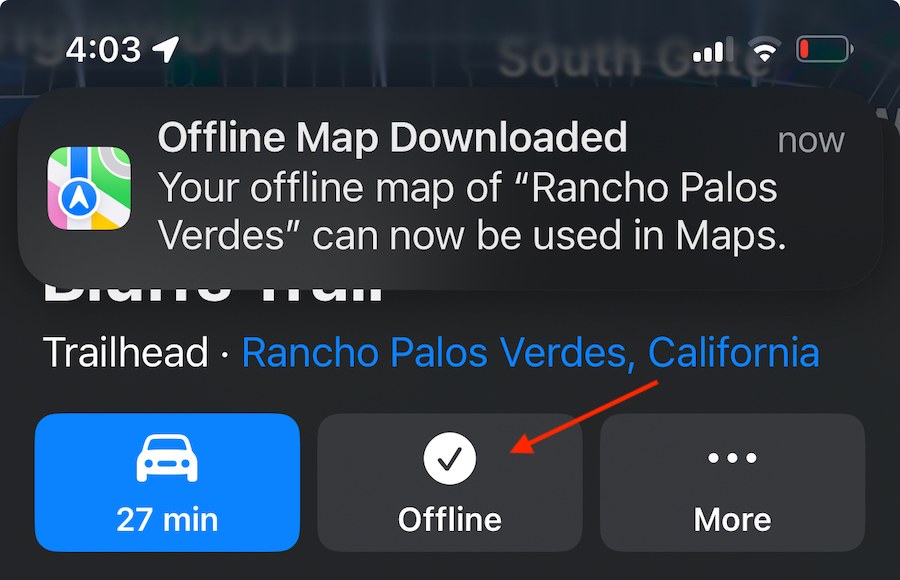
- A confirmation message showing Offline Map Downloaded completes the process.

As soon as you have downloaded the trail map, the icon for download changes to a checkmark Offline. This confirms that the trail map details are downloaded and available offline for you to use.
Downloaded maps on your Apple Watch
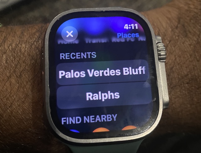
After downloading the maps to your iPhone, open up your Apple Watch and bring up the Maps app.
- Open the Maps app on your Apple Watch.
- Scroll down on the screen, and you will see the recent map you saved on your iPhone offline. This is usually found under the RECENTS section.

- Tap on it to open up the details.

- When tapping GO, you can follow the turn-by-turn directions right from your Apple Watch.
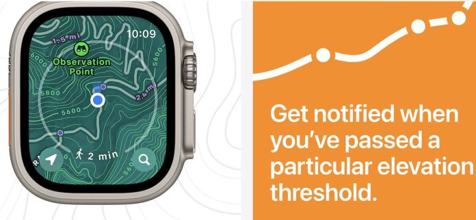
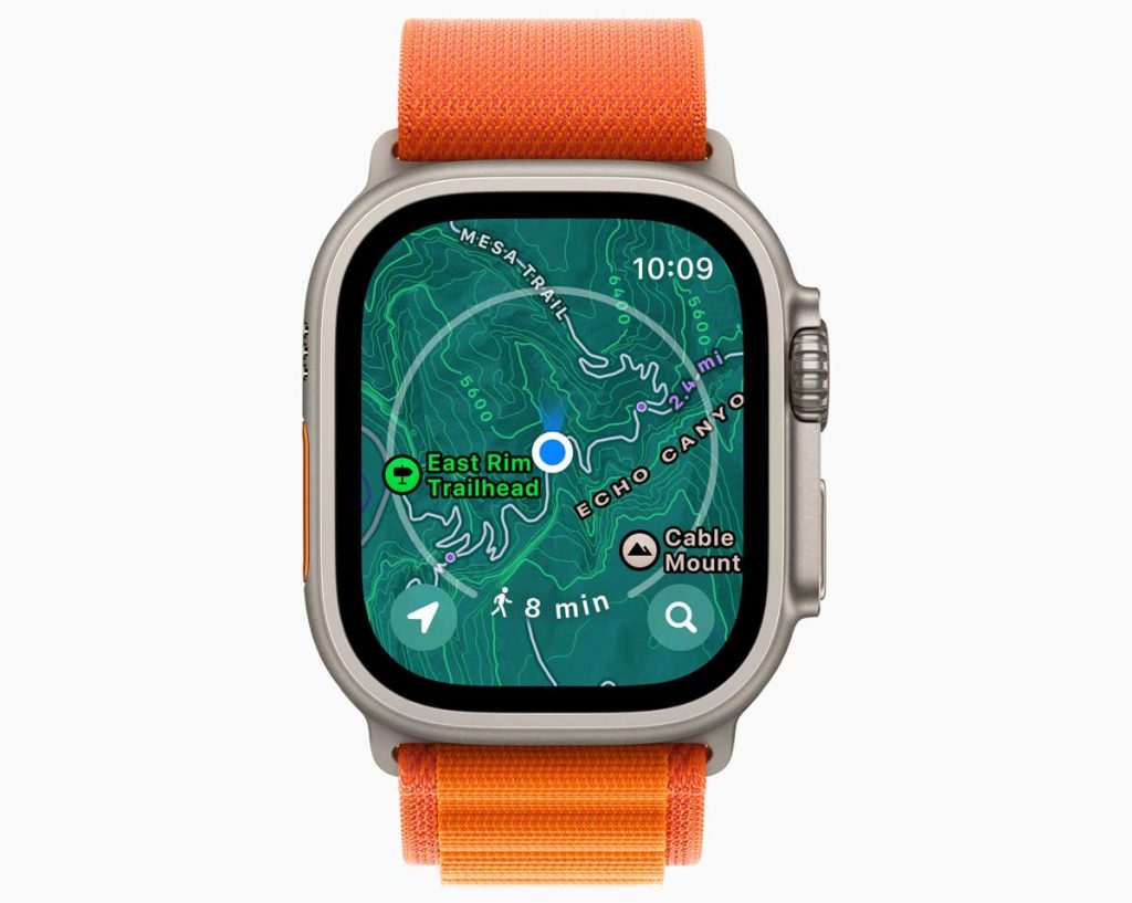
The first thing you notice on the Apple Watch maps is that now it shows contour lines, elevation details, as shading of the map itself. The shading helps you visualize the terrain.
The points of interest on the Map now show the trailheads and access to the nearest lodging and other facilities.
The Map view on the Apple Watch also shows additional points of interest and a thumbnail of some of the Photos showing the trail.
This appears to be a decent start. For seasoned users who have been using Workoutdoors or a paid subscription to Footpath Elite, the new Apple Maps features may still be lacking some key features.
Apple is rolling out topo maps first to California, then to the US, followed by other regions.
The Compass app on watchOS 10
When it comes to the new Compass app on the Apple Watch it can now create two new waypoints. 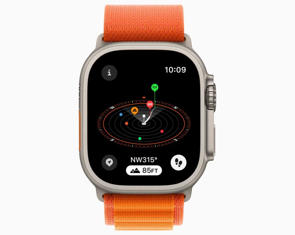
The first waypoint shows the last location where you had a cell phone connection, and a secondary waypoint shows up as ‘SOS,’ indicating a place where you can make an emergency call irrespective of the phone network.
Final thoughts
Apple is headed in the right direction regarding integrating map features into popular activities such as hiking and trail running.
Although Access to the offline maps will require you to have your paired iPhone ON, this is still a great start!!
Please stay tuned to this post as we thoroughly test out the new offline Maps functionality and its intricacies.

